Monday, 3 July 2017

Part 13 Mompiche and back to Quito, Ecuador, late Jun 17

Trip videos available for viewing at:

https://www.youtube.com/channel/UCPasfEADtrFeaD21vyg4Huw


Part 13 Mompiche and back to Quito, Ecuador

Beach Babe in Mompiche


Day 86 Mompiche, Ecuador

George and Claire met us in a rented car on the Pan-Am highway and we drove to the coast at Mompiche. The road brought us down quickly from the dizzying height at which Quito lies. Highlands gave way to pastures, formal crops and finally jungle on the lowlands. The heat was surprisingly comfortable and we didn’t even use the air conditioning. We encountered a bovine traffic jam.  See the attached video.


Mompiche is a fishing village/hippie surf hang out. We are in a log and bamboo hostal. If we look hard enough we can find someone who speaks a little English but we don’t look. This is a place where Ecuadorians come to holiday. We arrived at dusk and were keen to see the place in daylight. The beach is supposed to be clean and beautiful. We hope to swim tomorrow, it will be the first time we actually swim in the Pacific.

Typical Bamboo and Thatch Hotel in Mompiche


Day 87 Mompiche

The roosters began to crow outside our window at 4 am as the overnight rains began to diminish. We slept past 8am in the wonderful sea air and spent a slow day at the beach. The tide was out revealing a pristine expanse of fine sand. Remarkably, there is no garbage, seaweed or any other imperfection in either direction on the beautiful beach. The water temperature was perfect for swimming, not too warm. The slightly cool water must be what is maintaining such a perfect climate here. The days are warm and the evenings cool off enough to tempt one to put on a sweater. It is hard to believe we are so near the equator.

Naturally Beach Clean at Low Tide


Tonight, we had our best meal so far on this trip. There is a little Mexican restaurant across the sand road from our hotel, called Retaurante El Rincon De Mexico. Claire, George, Isabelle and I were the only clients this evening. The chef is shy but clearly enjoys the pleasure his work brings to others. The food really was spectacular. We started by sharing a large prawn ceviche and the main course was fish tacos in large, hard shells. Everything was presented elegantly.  We left a good tip and the promise of a glowing review on Trip Advisor. We followed that with a slow walk through the quiet little fishing village before bed.

Claire, George and Isabelle


Day 88 On the Road to Quito

The drive home began well but we hit our first delay looking for a bank machine. Each of us was out of cash. We have come to realize that a pocket full of cash is essential in Latin America. Gas stations will often but not always accept a credit card as payment but everywhere else won’t. The exceptions to the cash-only economy exist in large urban centres and even then, only in the most modern businesses.

Mompiche Beach


Once cash was acquired and food found we set off again but soon made a wrong turn, adding close to an hour to the trip.

The village of La Union on highway 20 was where the real trouble began. It is at this point that the long climb begins toward the high sierra along which “Volcano Alley”, the Pan-American highway south of Quito, runs. George and I had encountered a landslide clean-up and traffic jam here the previous week when returning from our rural tour. We had managed to filter past traffic on the motos and the police had waved us through the obstruction. This often happens here with motos.

Today we hit traffic that was stopped dead at about the same place. It ended up being a five-hour delay that caused us to pull into Quito after 11 pm. There was no filtering past traffic in our rented car. The landslide area was much larger this time. We saw it through the rain while finally inching past the lengthy, cleaned-up site. Huge mounds of mud and massive boulders had either been pushed off where the tarmac should have been or skirted entirely by a temporary road. The spectacle of natural force caused us all to hope that no one had been killed by the “derrumbe” (landslide).


Day 89 Quito

We slept late after yesterday’s excitement. Despite the road troubles Isabelle really enjoyed the three-day excursion. She is becoming more and more mobile as her injury heals. We will take on more activities in the coming days to help prevent further “cabin fever”. She hopes that soon she will be ready for her first test ride.

Home Life, Just Killing Time


George came over mid-morning and we went for a ride into the “hills” surrounding Quito. Quito sits at 2850m and the hills rise past 4,000m. Our route brought us “only” to 3600m before we crossed over the western range and began to descend. The dirt track brought us right down into the steamy jungle. We caught the paved highway near Mindo and rode it back into Quito. It was a fun ride on a twisty, well surfaced road. The ride was easily as much fun as the three hours we had spent off-road. We rode past “Mitad del Mundo” on the way back into the city and I made a mental note where it was.

Otavalo Roses Still Going Strong


Day 90 Quito

Today was a day of chores. I spent an hour cleaning and oiling the chain on Princess Leah. I use liberal amounts of kerosene as a solvent and it makes a pretty good mess. It’s best to do this before washing the bikes. Then I took both motos to an auto detailing place just up the road. Andreas did a great job in the almost three hours he spent working on them. I tipped him personally after his boss left with the pre-agreed $14 fee I paid.
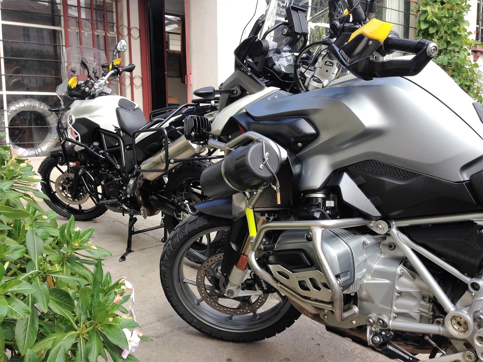
Dirty Bikes


Isabelle and I went for a “stroll” to one of the numerous small restaurants in our barrio (neighborhood). We each had today’s “Menu del Dia” or fixed menu for the day of a hearty soup followed by a plate of chicken breast in sauce (seco de pollo) that was accompanied by rice, a small salad and a slice of fried plantain. Almuerzo (lunch) like this can be found everywhere and costs $2.50. Today’s was the best we’ve had in our little barrio. We passed on our compliments and a nice tip. After lunch, we hailed a cab and rode to the grocery store to do some shopping. We finished the day by cleaning up some of our mess around the apartment.

Clean Bikes


It was a mundane sort of a day but it had been gently active for Isabelle. Painless, low level activity is useful in maintaining her strength at this point in her recovery.

Going Out for Lunch, Fun and Low Stress Excercise


Day 91 Quito

There is a segregated bus route that runs along the middle of Av. 10 de Agosto, near us. We took it north to the end of the line, then stayed on it for the ride to the south end of the city. We had enjoyed this little stunt in Medellin, along the above ground metro. The views gleaned had been our introduction to the geography of the city and had helped us plan the rest of the week’s activities. Today’s ride through Quito was anything but fun.

Nuestra Casa en Quito


The first two buses had been jammed full of passengers. The doors closed too quickly, after a few passengers exploded onto the platform, for us to even attempt boarding. We moved up the platform to the placed marked as a priority boarding point for people with ambulatory challenges. We got on the third bus and were immediately compressed (literally and firmly!) by our fellow passengers to allow the doors to slam shut. During the whole ride to the north end of the city we couldn’t budge, never making it past the crowded front entrance.

Everyone except us got off at the end of the line. The next stop had a mass of people waiting at it. When the bus doors opened they ran like school children to get a seat. The ride south was as unpleasant as the ride north had been. We took a cab home from the south end and promised each other we would avoid the bus in the future. We spent the rest of the day on our computers or watching Netflix. We looked at each other at some point and acknowledged our shared boredom. It will be good to get on the road again.


Day 92 Quito

“Ecuador” is derived from the word “equator”. Our taxi driver, Santiago took us north for about an hour, out of town to the lookout point atop Volcan Pululahua. It is an extinct volcano with a deep, flat and fertile crater. This is rare, the farmland within represents one of only two inhabited volcano craters in the world.

Agriculture in the Crater


We got back into Santiago’s taxi and rode to the “Mitad del Mundo” site. This is a plaza built at the end of the nineteen-seventies that “divides the world in half”. It was built to commemorate the 18th-century French expedition to help determine the exact circumference of the earth. It turns out that the actual location of the equator is in flux. It constantly drifts within 5 km on either side of the line that runs through the plaza. We straddled the line for a photo anyway, feeling light on our feet knowing that due to centrifugal forces caused by earth’s rotation we weighed about 1 kg less that at home.

With Santiago, Our Driver

Mitad del Mundo

(L to R) North and South

Part of the Monument at Mitad del Mundo


Some of the Traditional Music and Dance Performances


The accompanying photos show my moto-mounted GPS reading full zeros for latitude. It was taken on a solo trip on the dirt road up Volcan Cayambe a few weeks ago. It shows the true location of the equator, at that moment, as determined by the combined signals from at least 10 active satellites, no French expedition required!

Approaching the Equator on Road to Volcan Cayambe

Almost There

All Zeros Across the Top!


A couple of hours passed as we visited the site thoroughly, enjoying the traditional music and dancing shows performed throughout the complex. Santiago was waiting for us back at the taxi stand and we appreciated a scenic and different route home in his spacious cab. We gave Santiago $35 today and that included a good tip. We enjoyed his company, photos of his family, descriptions of his beloved city and didn’t miss the bus one little bit.

Part 12a A four Day Tour of Rural Ecuador, mid Jun 17

Four Day Highlands Tour

Links to videos:

https://www.youtube.com/watch?v=jK1qThDkS0k

https://www.youtube.com/watch?v=HEOr5W7GsLU

https://www.youtube.com/watch?v=IJQCy1h4SfU

https://www.youtube.com/watch?v=Y5axZxLrFU0

Isabelle is laid up with an injured ankle. We have rented a furnished apartment in Quito for a month while she recovers. She is doing better each day. We had planned to do a multi-day rural tour in the highlands south of Quito. We had also invited our friend George to ride with us. George is an English/Ecuadorian motorcycle enthusiast we met during our stay at his family’s Hosteria Rose Cottage in Otavalo. He shares a passion for music, especially vocal music, having attended a high-performance English choir school as a child. Isabelle very generously offered to lend her moto to George and insisted that we complete the tour while she recuperates in Quito. This four-day tour would have been too dangerous to do alone. Thanks for sharing it with me, George!

This posting is the story of that tour.


Day 1 of Quilotoa loop

George and I left Quito at 3 pm. The Pan-American highway brought us into Banos at about 6:30 pm. We were given partial views of Volcanoes Cotapaxi and distant Chimborazo along the way. Banos is set in a beautiful valley and is within reach of many outdoor activities. Its many hotels and lively night life serve as a base camp for outdoor adventures, much like a ski town in North America does.

Getting sandwiches for the ride out of Banos


Day 2 of Quilotoa loop (Banos to Salinas)

An early start got us riding down into the jungle east of Banos. The plan was to ride down and back, to return in time for breakfast at the hotel. It was an extra excursion that was outside our planned loop. We didn’t realize at the time that on day four we would experience the jungle more fully, below 700m on the western slopes of the mountain range.

We only got partially into the humid leafiness because there was a lot of altitude to lose and breakfast smelled good in our imaginations! We passed through dripping tunnels, beside numerous waterfalls and above deep gorges glimpsed through the mist. The good paved road allowed us to move quickly. The vegetation was at least as lush and thick as anything I had seen in Central America.

West of Banos lies the city of Ambato. We filled our tanks there for the almost 600 km journey we had planned that wound its way north along the spine of the Andes back to Quito. We wouldn’t be seeing another gas station for a long time.

The good paved road after Ambato brought us higher and closer to Volcan Chimborazo, the highest point in Ecuador and the closest point on earth to the sun. Our hearts were set to racing as the giant rose, the clouds revealing more and more of its height. During the approach, we first rode across sparse grasslands then barren expanses of rounded hills covered in volcanic gravel and ash. Chimborazo is an active volcano. We turned off the road, riding over the volcanic till that supported the heavy motos well. We settled on a spot for lunch at 4,400m (about 14,300 ft). The view of the active volcano from our vantage point was nothing short of spectacular even though the top half never was revealed. We were about as close as you could get to the volcano’s glacier with a motor vehicle.

Volcan Chimborazo Drone Photo 

Highlands Highway

Volcanic till and ash 

 Chimborazo played hide and seek with the clouds

Wild Vicunia in the Highlands near Chimborazo

Silhouetted against the clouds

Lunchbreak at 4,400m

Chimborazo Half Hidden by Cloud


Ash fields at 4,400m


We rode through the rain and down into Salinas on a good road, arriving in time to take a little hike up the valley behind the town. There were vertical walls of rock that rose to form the back vertex of a steeply floored, v-shaped valley. There was a damp cave to explore near the top. We walked down the secluded valley and peered over the cliff on which a big white cross was placed.  The town was laid out like a map below.

Starting off for Salinas


Salinas From Above

The salt mine on the south end of town must employ several people from the town. There are also a famous cheese and a chocolate factory. Tourism rounds out the town’s busy economy. Freedom Bike Rentals come through every weekend with a group, according to the owner of our hostel, and stay at his place.

Lobby of Our Hostel


The sun set as we sat on a park bench in the village square watching a heated volleyball match. The hostel was very nice and almost empty, it being the middle of the week. It cost $15 for a nice private room and bath for the night.

Vertical Cliffs that frame the town


Day 3 of Quilotoa loop (Salinas to Angamarca)

An early start and clear skies in the morning allowed us to move at about 20 km/hr over the double track dirt roads. The clear skies afforded great views as we rose above 4,000m again. We had lunch in Talaguapungo where I gave out some Canadiana souvenirs that put smiles on children’s’ faces. If you look up these place names on Google maps you might find them but you won’t find the roads going north that we went on next.

Scenes from the Morning Ride


Things became rough north of Talaguapungo. The dog biting my leg as we rode out of town might have forewarned me of the change in our luck. What is it with motorcycles and dogs? The rain, mist and fog added new dimensions of difficulty, making forward vision a strain. There were almost constant “death plunge” drops on one side of the road but we couldn’t see down them very far because of the fog.

 Drone Photo north of Salinas


The village of Facundo Vela marked the beginning of real toil. Mud and roads turning into little rivers became the norm. We took the shortest route north towards the town called El Corazon at the fork. This narrow road eventually crossed the Rio Jinambi and led toward El Corazon. After El Corazon it looked on the map like a clean ride to Zumbahua, then a paved road to Quilotoa for the night. We passed many indigenous people, waving at each person or group as we encountered them. They responded in kind but gave no warning of what was ahead.

Fantastic views


The road became a flowing muddy track that constantly switched back sharply on its self as it fell down into the jungle below. This lasted for 45 minutes (about 8 km), until the road simply wasn’t there any more. I had taken a bit of a hard fall about ten minutes before. The way had been rough and I was moving very slowly. I hadn’t seen a softball sized stone in the track. The stone deflected my front tire rapidly to the left, soon after the bike and I connected with the ground on the right.

Fun Roads


George took the lead. He was the best choice for point man because he doesn’t wear glasses. His vision is not obscured in the rain and mist. Suddenly, George braked, causing his front wheel to dig into the mud and for him to take a tumble. Better that than to try out the death plunge ahead. He landed about 10m before the precipice. I had already committed to following him down a slope that led to the landslide before I saw him fall. I steered to the inside to avoid George’s downed bike. The outside choice would have led to the ever-present death plunge. My wheels bogged down in the deep mud at the bottom, in front of the landslide scar. We walked ahead to inspect the void before us, simultaneously coming to the conclusion that the long way to El Corazon was in fact the better choice.

Above the Clouds


Turning around was lengthy and possibly a little dangerous because of the vertical drops so close to our footings. Much pushing, spinning of tires and slinging of mud got the job done and we were on our way, reversing our course within 15 minutes. We passed the same groups of people working in the rain at the road-side but held back the urge to comment. The impasse in the road was likely weeks old, another result of the difficult rainy season just ending, but no one had warned us.

Too High for Farming


Back at the fork, 2 hours after our first time there, we turned northwest toward the Rio Pinanato crossing. An hour of tough riding brought us to the road leading east, toward El Corazon, the town we were beginning to think we would never see. We didn’t find the rough track marked on the map that went more directly east toward El Corazon. We took the longer loop north that used a paved road at times, finally reaching the elusive El Corazon.

Clouds from Above


Quilotoa, our objective for the day, was still 100 km away. It was too late in the day to ride that kind of distance in these conditions. We scaled back our expectations to Zumbahua, having seen numerous hotels on the map there while we ate breakfast. We had coffee and snacks in El Corazon before setting off again, unaware that we would not even make it to our scaled back objective before dark.

The "Real" Ground is Somewhere Below


A few minutes out of town there was a fork in the muddy road. The sign said Angamarca (a waypoint on our intended route) to the right but the GPS preferred the much shorter left turn. Our time and distance calculations had been based on the left turn. A pick-up truck stopped and the driver helped us make our decision informing us that the left turn was not a possible route to Angamarca, its condition was too poor. We chose to heed their advice after our landslide encounter and we turned right.

Carpet of Cloud Close to Sunset


The going was slow and made more difficult by the loss of light. Sunset at the equator is quick. There is not the slow ceremony we are accustomed to at higher latitudes. We pulled into Angamarca well after dark. There had been no indication of hotels here during our search at breakfast so we started asking. I had read on travellers’ blogs that when you are stuck and in need of a bed you should ask around in the nearest town, often someone will have space for you.

Bikes Safe Inside for the Night


We eventually stumbled upon someone at the tiny church plaza offering to take both of us and the bikes in and to feed us for $10. The only hitch was we had to get the bikes up two large steps then two more steps and through a corner doorway. Our host had three strong sons and an idea.

Sweet Slumber


He brought out a 2X10 plank and made a ramp up the first set of stairs. We hummed and procrastinated long enough for one of the sons to jump on his two-stroke and show us how it was done. He mounted the ramp with ease on his little bike that has a quarter the weight of mine.

"I thought I heard pigs last night"


Seeing that I still wasn’t impressed our host pulled out another plank, laying it on top of the first one. A milk crate and a leaned over bench provided further support underneath the make-shift ramp and we gave the plan a try. I put the front wheel of the 1200 gingerly up the ramp while the lads balanced things, pushing on either side of the bike. I gave a tiny amount of throttle and slipped the clutch gently to complete the climb. The top plank splintered and was shot backwards by the force of the engine but the tiny bit of forward momentum generated was enough to carry the bike and I to the level concrete slab above.  OK, one down…or up and one to go.

Photo of the stairs and corner door in the morning


Convinced by the splintered plank that brute force doesn’t work I decided to try momentum and courage. A small running start worked much better and required no power delivery while the bike rolled up the wood. The 700 made it easily beyond the narrow ramp onto the concrete slab above. Getting the two motos up the next set of steps and through the corner door was accomplished using brute force but this time that force was provided by the lads and their friends who had gathered to watch the spectacle.

Bikes at Ground Level Again


The motos were tucked in safely beside two covered and very dusty pool tables for the night and we were shown our beds. We stepped through the kitchen where our host’s wife was tending to four large caldrons on a long gas stove. Continuing through the pantry, up the stairs, out the short doorway (duck!) up more stairs past family’s outdoor toilet, finally up more uneven stairs to a six-bed bunk room. We had the room to ourselves.

That night we enjoyed a wonderful dinner of simple food with this rural Ecuadorian family. There were smiles and much chatter during “cena” (supper). The Mom gave a humble shrinking gesture to accompany, “Gracias” when I complimented her cooking. Everyone was interested in the story of our journey and had questions about our homelands. Our host, the patriarch, had a sophistication and subtle confidence his sons had not yet acquired. His mature, measured gestures and speech were in contrast with the bolder booming of his sons. We excused ourselves at about 9 pm and went to bed. It had been quite a day!


Day 4 of Quilotoa loop (Angamarca to Quito)

Using a combination of rocks, bricks and the dreaded planks we got the two motos safely to ground level. George shook hands with and gave our host a $20 bill, double the agreed price. That produced a big smile. Then it was my turn and his smile changed to a look of incredulity. A minute later his wife gasped and put her hands to her mouth when shown the two twenties. We had the pleasure of bringing a bit of joy to this family and it was so easy. We also encouraged their continued kindness toward other travelers.

The way out of Angamarca overlooked deep lush valleys and passed by Moms and Dads walking their uniformed children to school. Each group we passed gave a smile and a greeting. Fourty-three kilometers ahead lay Zumbahua, then a paved road to the main event of the trip, the Quilotoa crater lake.

Crisp Winds and Brilliant Highland Views


Clear skies made for crisp winds on the highlands we rode over that morning. The vistas truly were breathtaking and led to much picture taking. We rose past 4,000m a few times, eventually reaching 4,200m elevation. We looked down on mountain tops poking through an endless sea of cloud. There was no sign of the “real ground”, just the distant horizon of fluffy white.

Stopped to Set Up a Drone Shot at 4,200m


We stopped and made some drone shots but the altitude eventually proved to be too much for the little buzzer. The smallest of downdrafts sent the flying camera crashing to earth. We got a couple of good shots and paid for them by clamouring around the slopes looking for the downed drone, breathless from the effort at high altitude.

Highland Plants on a Sheltered Slope


By 10 o’clock we reached an unnamed village. It does not appear on any of the maps I have seen. The approach to it revealed extensive damage from a trying rainy season. Evidence of landslides, flooding and the presence of muck everywhere told their story. The route over the mud-covered cobbles that paved the village plaza was blocked by caution tape. We asked for directions through town to continue on toward Zumbahua. Watch the attached video to see the fun that resulted from this request for help. Once again, the tiniest bit of generosity, in this case a few gifts of Canadiana stickers and key chains, broke the ice.

Finally, Quilotoa!


It was in fact an hour’s journey on easy gravel and in great weather to the substantial town called Zumbahua. Lunch in Zumbahua was followed by beautifully paved roads that lead us to the long anticipated Quilotoa crater lake. The cauldron is covered by a large, calm lake that contrasts with the violence that formed the crater. The lake is a strong turquoise colour and is perfectly protected from wind by the high, circular sides of the extinct volcano. We took many photos and much drone footage, then we just sat and listened to the wind and the birds. We were the only people at our vantage point and did not have an urge to leave.

Quilotoa From the Drone's Perspective


The way north from Quilotoa began with some wonderfully fast mountain curves, on perfect asphalt surfaces. Half an hour later the road scars began. Large chunks of the new road had been swept away by landslides. One end of a bridge was missing and a temporary gravel route had been constructed. Cracked and slumping tarmac forewarned of future landslides. Some of the work sites were really rough, even for our bikes. Regular cars wouldn’t make it through. Deep mud, sand and stream crossings at washed out bridges characterized the numerous landslide repair sites. Not surprisingly, we encountered no traffic for many kilometers.

Looking back up the Trail from the Lake


A coffee break in Sigchos meant we were about to begin the last difficult part of the trip, the road north through San Francisco de las Pampas to La Union del Toachi and the paved highway. The climb brought us back into the clouds and mist and muddy roads. All out rain followed for hours as we slogged our way once again through a tough, challenging and fun ride.

Quilotoa Scene


The last portion of the route was below 700m elevation and we were thrilled to find ourselves in real jungle. Waterfalls, huge plants, fast rivers, new smells and humid air surrounded us as we picked our way forward. We got to the E20 just before dark. We had abandoned our plan to cross it and to continue on the muddy jungle double track. That route made the climb up and over the mountains surrounding Quito. We would have to save it for another time.


It's been a Muddy Trip!


We turned right hoping to complete the 2500m climb into Quito quickly on tarmac. There was a huge traffic jam. We filtered past kilometers of cars and trucks before we reached the site of yet another landslide clean-up. We were waved on by the police as the machines worked to repair the damage. This often happens, motos being waved on at construction sites. We emerged on the other side to find that we had the road to ourselves. It became very foggy for the long climb to the Pan-Am highway and seemed to take forever. We finally got home at 8:30, having ridden for about 13 ½ hours. It had been another huge day, one of tremendous variety and challenge.

Jungle Scene Below 700m Elevation


The entire four-day trip outlined above, featured some of the best riding and scenery I have experienced. Interactions with every-day Ecuadorians, people not employed in service industries, remain and resound with me. I resolve to include a multi-day rural tour like this in each new region Isabelle and I encounter throughout South America.

George's Drone Video Summing Up the Trip


Isabelle’s ankle will soon be healed and she will be capable of continuing the adventure. We love visiting the many fantastic tourist attractions along our way, they are called “attractions” for very good reasons. Rural, off the tourist track routes provide additional and unique opportunities to experience and to come to some understanding of the land and of the people in a new region.

It is the wish for these rich experiences, the empathy and understanding that may come from them, that caused us to accept the risks and to embark on this wonderful motorcycle journey.


Part 43 - Situation: Stuck in Spain, Dilemma: Deadline in Dublin

Situation: Stuck in Spain, Dilemma: Deadline in Dublin All sailings for the week to Ireland, where I planned to store my motorcycle, w...